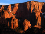
 | Cache Hunting, Hiking, and OtherAstounding Adventures Photo: April Sun Sets on Timber Top MountainIPv4You are not logged in. Click here to log in. |
Here are some of my cache hunting (or other) adventures, with a few other items scattered throughout:
Page 1 of 4
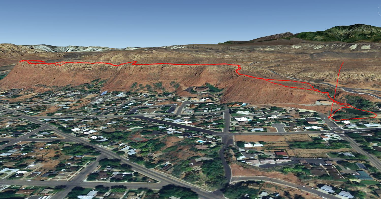
Late Spring Hike Up Shinob Kibe
Monday, 30 April 2012 10:53 PM MDT
Yakkity Yak, Astounding Adventures
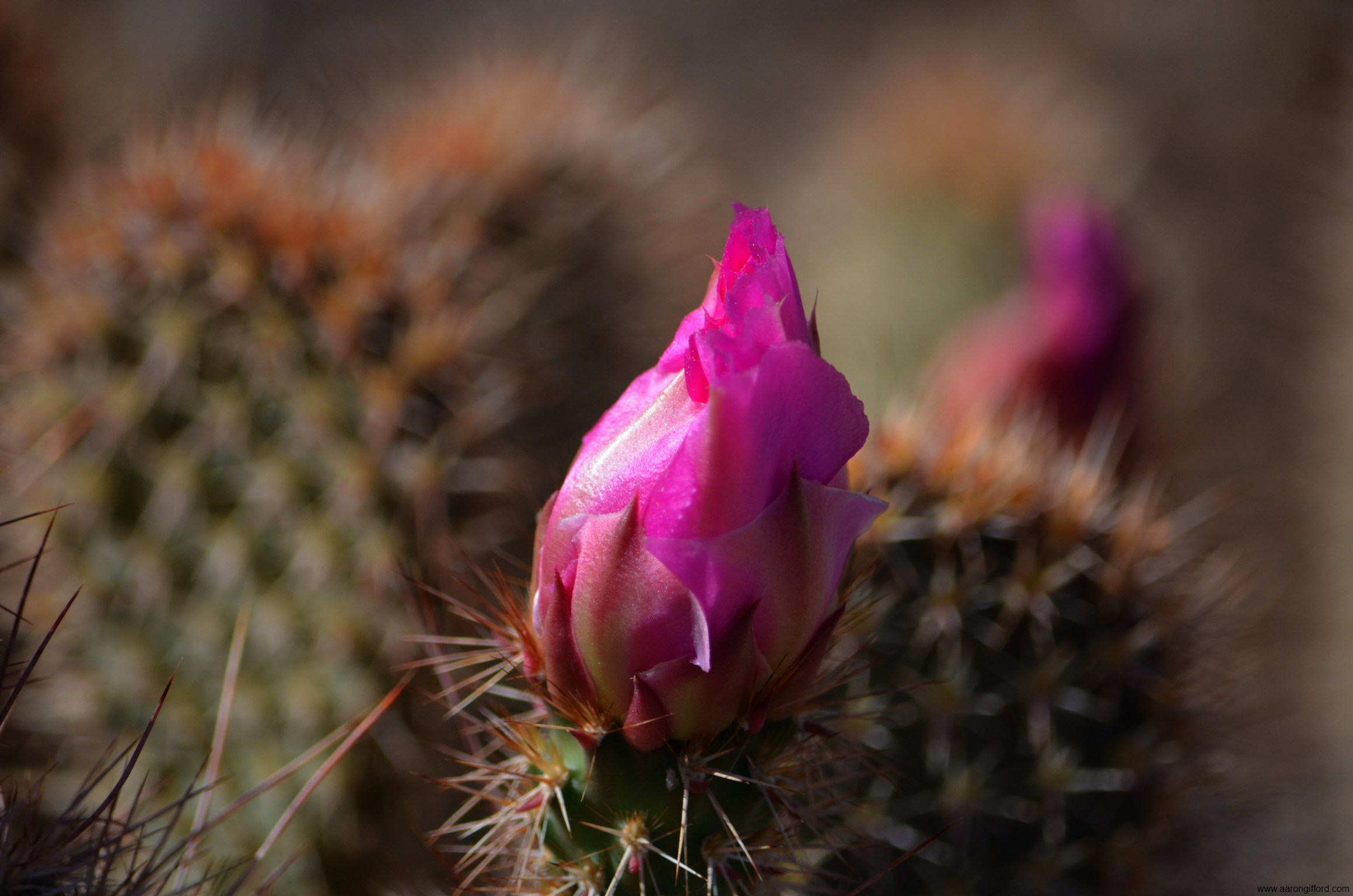 Desert Cactus in Bloom Desert Cactus in Bloom
Monday morning I went hiking up the nearby Shinob Kibe mesa in Washington, Utah. Though most desert flowers had long since dried out, there were still some splashes of color in bloom along the path. With camera in hand, I went a little snap-happy, then posted the results on Facebook. Here is my Facebook photo album of my Shinob Kibe hike. Mollie's Travels in Utah
Friday, 12 August 2011 11:40 PM MDT
Yakkity Yak, Astounding Adventures
 Mollie's Nipple as seen from the road atop the Hurricane Cliffs looking northward in April 2004Having grown up in Hurricane, Utah (well, mostly), no one in town would think twice to announce "I'm going to hike up Mollie's Nipple" when talking about hiking up the nearby Hurricane Cliffs escarpment and then surmounting the 400 foot hill on top, Mollie's Nipple. It was just the name of a geological feature overlooking the Hurricane Valley, albiet descriptive. Mollie's Nipple as seen from the road atop the Hurricane Cliffs looking northward in April 2004Having grown up in Hurricane, Utah (well, mostly), no one in town would think twice to announce "I'm going to hike up Mollie's Nipple" when talking about hiking up the nearby Hurricane Cliffs escarpment and then surmounting the 400 foot hill on top, Mollie's Nipple. It was just the name of a geological feature overlooking the Hurricane Valley, albiet descriptive.
I recall while in Varsity Scouts ascending Mollie's Nipple with mirrors to send signals to other Varsity Scouts on surrounding mountaintops as part of On Target. Quite fun! 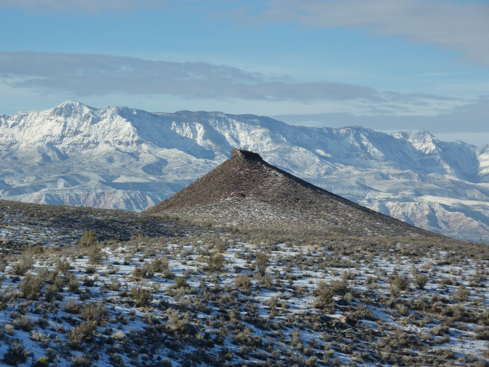
Mollie's Nipple on New Years Day 2011Owen Sanders of Hurricane—a neighbor of mine who has since passed away, a kind and talented gentleman who befriended me as a teenager and who would share his poetry with us fellow Hurricaneites—composed a poem that is inscribed on a historic marker in Heritage Park in Hurricane, placed there in 1991. The poem by Owen Sanders and subsequent marker text reads: SEE MOLLIES NIPPLE "IT'S A BUTTE"
Even though as a kid I thought Mollie's Nipple was a volcano, it is not. It is a remnant of an ancient lava flow that ran in a valley, subsequent erosion and the changes in the Hurricane Fault having left it now a high point overlooking the valley. Todd Furse pointed out this article, titled Inverted Topography in St. George Area on the Utah Geological Survey web site that describes the process that formed Mollie's Nipple.
SEE MOLLIES NIPPLE - CLIMB MOLLIES NIPPLE by Owen Sanders This pinnacle piercing the skyline On the crest of the Hurricane Cliffs Is a vivid, visible landmark That has sparked many frontier tiffs. The playful pioneer naming the nipple Was lost in the annals of time But Mollies who winced at jabbing jest Survive in sparkling rhyme! Breathtaking vistas of awesome charm Can be seen from the Nipples crest And silently vie with any view That is lauded throughout the West! To clamber like goats to the Nipples Nib Takes vigor of muscle and wind And laggards with fleeting devotion Are left on the trail far behind! The magic of mind to climb for the crown Is the goad for gaining a goal; Should your body grow weary from climbing— Consider the gift to your soul! Mollies Nipple was given its historic name by pioneer colonizers of Toquerville, Virgin City, Grafton, Rockville, Springdale and other communities along the Rio Virgin. The unique symmetry of this visible Dixie landmark is protected from rapid erosion by a massive capstone of volcanic rock. Indian throwing sticks for hunting small game, and hardwood fire tongs used to pick up hot stones from camp fires and drop them into pitch lined baskets for cooking purposes, were found in small caves at the base of Hurricane Cliffs below Mollies Nipple. Hundred of hikers have climbed to the crest of Mollies Nipple to view a vast circle of breath-taking, colorful, geologic and historic wonders, unmatched by any view in the world! Pottery shards were found by hikers on top of this butte, indicating Indians likely used this landmark to send up smoke signals to hunting and seed gathering parties. Take the time to make this scenic climb! It rises 400 ft. above the crest of the Hurricane Cliffs. The historic Nipple rises 1353 feet above the fertile Hurricane Valley. Mollie's Nipple and Molly's Nipple Locations in Utah When I placed the cache, using some topographic map software on my PC at the time, I searched the U.S. Geological Survey database included in the software for the term "Mollie" and discovered there were five peaks in the state of Utah bearing the name "Mollie's Nipple". Prior to posting ths 'blog entry, I decided to search again for "Mollie" and "Molly" within the state of Utah. Using the online U.S. Geological Survey National Geologic Map Database I learned that there are indeed five hills or peaks in Utah that are officially named "Mollie's Nipple" but also a few more named "Molly's Nipple". Additionally, there's a place called "Tatow Knob" that unofficially is yet another "Mollie's Nipple". Wow! Here are the one's I found this time:
Mollie or Molly apparently was quite the explorer and managed to make a name for herself all over the state of Utah. If the Molly in question was a Mormon, then she must be the very Molly Mormon I've heard so much about. Or perhaps not. It turns out, someone has put together a Mollie's Nipple Wikipedia article that lists most of these places too. UPDATE: 24 Aug. 2011 I found this page with pictures and information about the Mollie's Nipple northeast of Kanab in the Grand Staircase-Escalante National Monument. COMMENTS: Date: Friday, 08 June 2012
From: Bob Durtschi Subject: another one in Wasatch County There's another "Mollie's Nipple in Wasatch County just north of Midway Utah. My dad would point it out to us as we drove to my grandpa's home in Midway where Dad grew up. Dad said there would be a lot of lightning strikes there during a thunder storm On the Trail of Some Bad Data
Saturday, 30 April 2011 2:00 PM MDT
Astounding Adventures, Yakkity Yak
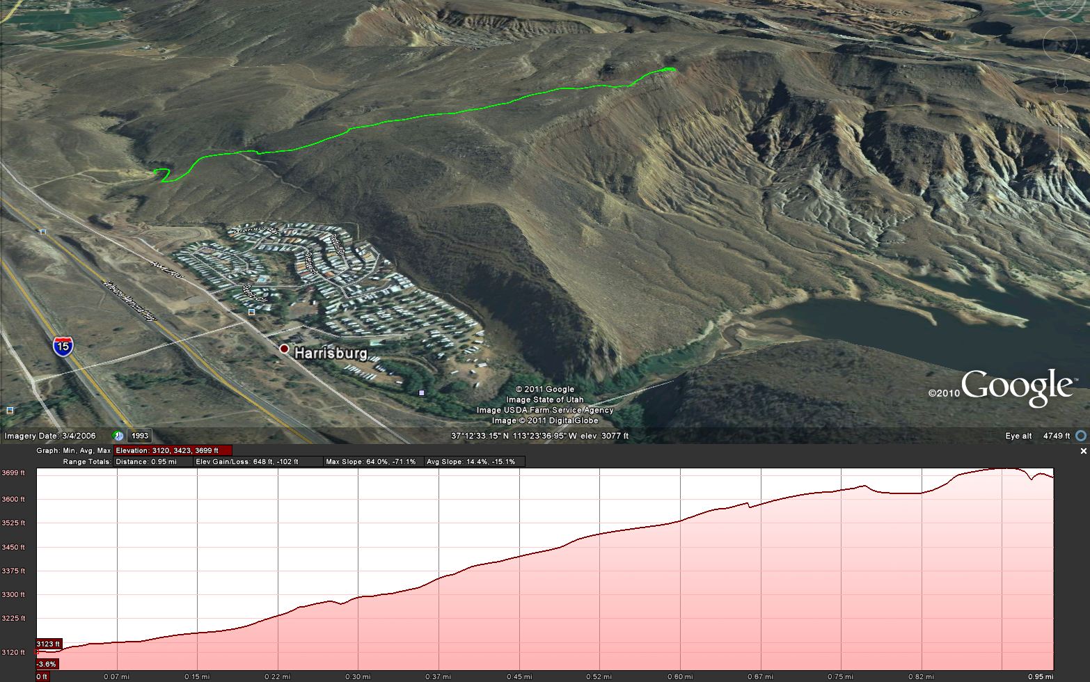 Hike route to cacheCache Found: If You Dare Drive by Baad Daata Hike route to cacheCache Found: If You Dare Drive by Baad Daata
Saturday, 30 April 2011 - 2:00 PM MDT (-0600) On this cool, windy last day of April, I went hiking with my brother. We parked down by the stream at the base of the hill near Harrisburg. We then proceeded up the road toward the cache site. The hike is uphill nearly the entire way, ascending about 580 feet in altitude from the stream bottom to the point above the cache overlooking Quail Creek Reservoir. Although the distance is only about nine tenths of a mile one way, because the trail is continually climbing, it takes more time to hike it. Originally, I'd intended to find this cache, then continue on to my Quail Creek East Overlook cache further southeast along the ridge, but due to time constraints, and the fact that up on top, the breeze was more of a wind and I was beginning to feel the cold, this trip became a one-cache-only hunt. There were several caches close to the bottom where I parked my vehicle that I would have visited too, had there been more time. (I'll definitely be back.) The desert was in bloom. All over the hillside, bushes and shrubs were blooming, some bedecked in yellow flowers, others white, and the prickly pear cacti sporting pink petals a-plenty. I love hiking in the desert in springtime. About the wind. At the bottom, it was mostly a gusty, hearty cool breeze occasionally blowing hard enough for me to classify it as a wind. But as we ascended the hillside, the wind decided to breeze no more and just blow. But it was nice having the air as we hiked, keeping us cool. It was only when we stopped at the top to survey the vistas around and hunt for the cache that we felt the chill. The cache was nicely hidden in an excellent spot. I made a brief log entry in the notebook. Wow, it appeared we were the first visitors since October 2010. Then I traded a couple of gold dollar coins for a carabiner with key ring. Did I mention the view? The view was superb! Quail Creek Reservoir was below us, a few brave jetskiers braving the wind, the wind pushing moving patches of scaly-looking waves and ripples across the surface. Sand Hollow Reservoir was also visible in the distance, as were the sewage evaporation ponds across the Virgin River. Of course all the mountains and hills around us were visible too. Pine Valley Mountain, still with snow patches accenting the cliffs, with those stunning red sandstone cliffs below, was most prominent. The sky was mostly blue with patches of white, fluffy clouds scudding around the mountain top. It was gorgeous! Stunning! Beautiful! What a beautiful area southwestern Utah is! Thank you for a great cache! TO DO: Add pictures from the hike... A Quick, Fun Hike Right in Downtown St. George
Sunday, 30 May 2010 9:19 PM MDT
Astounding Adventures, Yakkity Yak
 Owen's Loop Trail along the St. George Red Hill rim - Approx. 1.5 miles one-way, 3 miles round trip)I've hiked this trail (the Owen's Loop trail) a bunch of times this spring. It's close, right in town. I can drive up to the Brooks Nature Park at the top of Main Street (452 North Main, St. George, Utah), park, and head right up the trail. Owen's Loop Trail along the St. George Red Hill rim - Approx. 1.5 miles one-way, 3 miles round trip)I've hiked this trail (the Owen's Loop trail) a bunch of times this spring. It's close, right in town. I can drive up to the Brooks Nature Park at the top of Main Street (452 North Main, St. George, Utah), park, and head right up the trail.
Please forgive and ignore the obviously wrong GPS route data that caused the straight red lines on the left-hand side of the Google Earth route map screenshot. This trail is also a fun one to do in the evening. I've watched several sunsets from atop the Red Hill. My most recent trip was on Friday, the 7th of May, 2010. I found the Grandpa's Toolbox geocache out at the end of the trail where it does a loop on the westernmost side of the Red Hill. A Super-Fun Hike (Two Months Ago)
Sunday, 30 May 2010 9:08 PM MDT
Yakkity Yak, Astounding Adventures
 Hike Route in Google EarthThis evening I downloaded a bunch of old waypoints and tracks from my GPS and plotted them in Google Earth (using a Ruby script to covert the GPX data to KML). I found this route that Kendall and I hiked one eveing, on Tuesday, 16 March 2010. It was a BLAST! Hike Route in Google EarthThis evening I downloaded a bunch of old waypoints and tracks from my GPS and plotted them in Google Earth (using a Ruby script to covert the GPX data to KML). I found this route that Kendall and I hiked one eveing, on Tuesday, 16 March 2010. It was a BLAST!
I need to do that one again. It's especially nice in the evening. You arrive at the edge overlooking State Route 18 and Snow Canyon, a perfect place to watch the sun set over the sandstone crags of Snow Canyon State Park. And traversing the rim of the southern Diamond Valley extinct volcano cinder cone is fun too. I think Kendall said they used to refer to this (or a similar hike) at Red Mountain Spa as "Jones' Bones"--due to the, ahem, remains atop the hill. (Don't worry, they're just old, bleached animal bones someone found, collected, arranged in a display beside the trail to look a bit like human remains.) Big Rock in a Hidden Nook
Thursday, 18 March 2010 10:28 PM MDT
Astounding Adventures, Yakkity Yak
 Another Evening Hike in the Red Cliffs Desert Reserve North of Washington, UtahSo Kendall and I went hiking again. This time we parked at the new Washington, Utah exit against the base of the red cliffs Interstate 15 passes by and started up the road, into the Red Cliffs Desert Reserve along the Grapevine Trail. Another Evening Hike in the Red Cliffs Desert Reserve North of Washington, UtahSo Kendall and I went hiking again. This time we parked at the new Washington, Utah exit against the base of the red cliffs Interstate 15 passes by and started up the road, into the Red Cliffs Desert Reserve along the Grapevine Trail.
We followed the path (it was a dirt road) as it wound up the hill then headed northward beneath power lines that feed a well in the sandstone watershed foothills of Pine Valley Mountain. About two-and-a-half miles up the road, the road ended (at the wellhead) as did the power lines, and before us, in a sandy bowl, was a big chunk of sandstone at the very bottom of the bowl, surrounded on the west by black basalt cliffs from an extinct volcanic vent (an old cone stood above the cliffs, likely the source of the ancient lava flow), and on the east by the sandstone foothills of Pine Valley Mountain. Despite the path being a road instead of a hiking trail, it travels through beautiful desert terrain. The weather was cool, a storm mounting north of us atop Pine Valley Mountain, the sun sinking quickly in the west, the air pleasantly cool as the distant storm blew soft tendrils of breeze down from the mountain towards us. And the sandstone playground at the end of the hike was well worth it! Grapevine Trail ends and Bracken's Loop Trail begins at the rock. I don't know what the rock's called, so I started calling it Bracken's Rock. At the base of the rock, Grapevine Wash forks and winds around the rock base on either side, carving the sandstone, sculpting it as only nature can. Both Kendall and I had to scramble up the rock to the top, just to say that we did. I sat for a bit on the top, then stood, as the breeze picked up and began gusting from the north as the distant storm boiled and brewed above on the mountain slopes. Before we left, Kendall and I had to test the acoustics by singing at the top of our lungs. Sure enough, the black basalt cliffs on one side and sandstone hills on the other provided perfect echo surfaces, singing right back at us. We departed Bracken's Rock following the Bracken's Loop Trail northeastward along the base of the basalt-sprinkled hillside, then eastward, then up out of the wash bottom to the base of the sandstone cliffs there, then southward. Since we didn't have a map and weren't sure how long Bracken's Loop would be, and since it was getting dark quickly, the sun having set some time ago, we decided it was best to turn south, and followed a fork of the wash along the sandy bottom bottom, then linked up again with the original Grapevine Trail. The hike back was enjoyable in the dark, the storm behind us on the mountain blowing cool, cool air against our backs, and the lights of Washington glimmering here and there before us. We rounded the end of a hill and angled westward again, and suddenly, spread before us, below us, were all the lights of St. George and Washington, revealed in their glory. It was beautiful. Thankfully, the lights of the communities reflected of the cloud cover to light our path, since no stars were visible, and the sliver of moon we'd seen earlier was now obscured by thickening cloud cover. When we arrived back at the vehicle, my GPS claimed our adventures had taken us 6.28 miles. Not bad for me, considering that post-Sept. surgery I could barely walk a few city blocks (back in October). Thanks again, Kendall, for some good, fun exercise in the beauty of Southwestern Utah's spectacular desert landscape. P.S. Kendall, you'd better post some of your pictures. A Pleasant Evening Hike
Thursday, 11 March 2010 7:35 PM MST
Yakkity Yak, Astounding Adventures
 Hike Route - 4.3 MilesKendall stopped by and grabbed me from work this afternoon before the sun went down so we could get out in the beautiful weather and light and go hiking. We wanted some place close by, so we chose the Chuckwalla, Turtle Wall and Beacon Hill trails (the three form a loop) in the lower Red Cliffs Desert Reserve. Hike Route - 4.3 MilesKendall stopped by and grabbed me from work this afternoon before the sun went down so we could get out in the beautiful weather and light and go hiking. We wanted some place close by, so we chose the Chuckwalla, Turtle Wall and Beacon Hill trails (the three form a loop) in the lower Red Cliffs Desert Reserve.
It was a beautiful late afternoon/early evening, the sun hitting the red cliffs at a lowering angle, the air crisp and cool. We parked at the Chuckwalla trailhead lot immediately off Utah State Route 18 just north of where it crosses Snow Canyon Parkway in St. George, and started down the trail, descending into the canyon past a cliff wall packed with people rock climbing. There was quite a crowd on the cliffs. The trail was down hill for the first part, descending into the canyon carved by Halfway Wash. It was nice, as it got me limbered up, warming me up for the rest of the hike. The Chuckwalla trail descends to the Halfway Wash floodplain, then follows it northward. After a while following the wash north, at a trail intersection, we turned westward, crossed Halfway Wash, and immediately started up the hillside, and were soon walking on slick rock, weaving along the base of the cliffs on the Turtle Wall Trail. I've got to say, the Turtle Wall Trail in the evening light is stunning! Just a hair past the two mile mark, we reached a look-out point overlooking the Entrada golf course, green fairways nestled in black basalt ancient lava beds far below us. After a pause at the overlook, we headed northward, until we intersected the Beacon Hill Trail, where we turned eastward and churned through the sand, then descended back into Halfway Wash. As we descended again, the sun hit the sheer red rock cliff face in front of us on the western side of Halfway Wash, below State Route 18 (but you can't see it from the road). What a beautiful sight! Once at the bottom of the wash again, we followed the trail southward, back to our point of origin. It was a hike made-in-the-shade (literally, as the sun was so low that by this time the canyon bottom was in shade). The hike ascending back up the eastern side of the wash to the parking lot was the perfect end to the hike, even though by now my fingers were a bit chilly and I was ready to get in the vehicle and warm up a bit. Thanks, Kendall, for stealing me away to get some exercise outside! Comment by 'Yer Mom' posted on Sat. 13 Mar. 2010 at 12:36 PM MST (-0700)
Subject: Hiking in general... Could an old woman like me make the hike? I WANT to go. Who will steal me away from work? Gorgeous Hike to Snow Canyon Overlook
Tuesday, 02 March 2010 9:13 PM MST
Astounding Adventures, Yakkity Yak
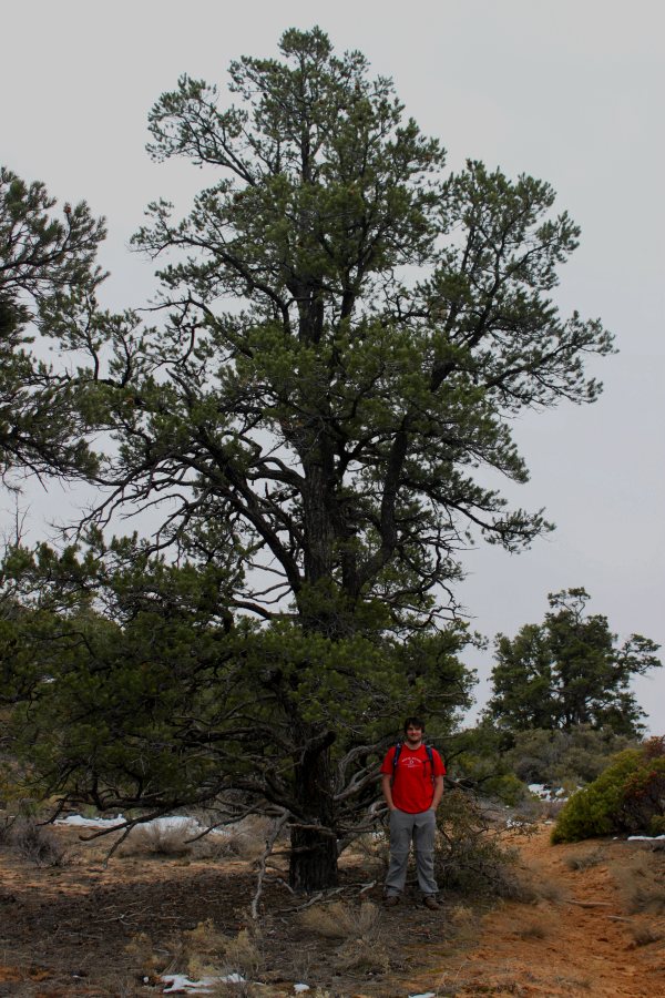 Kendall on the Trail Beneath a Pine Kendall on the Trail Beneath a Pine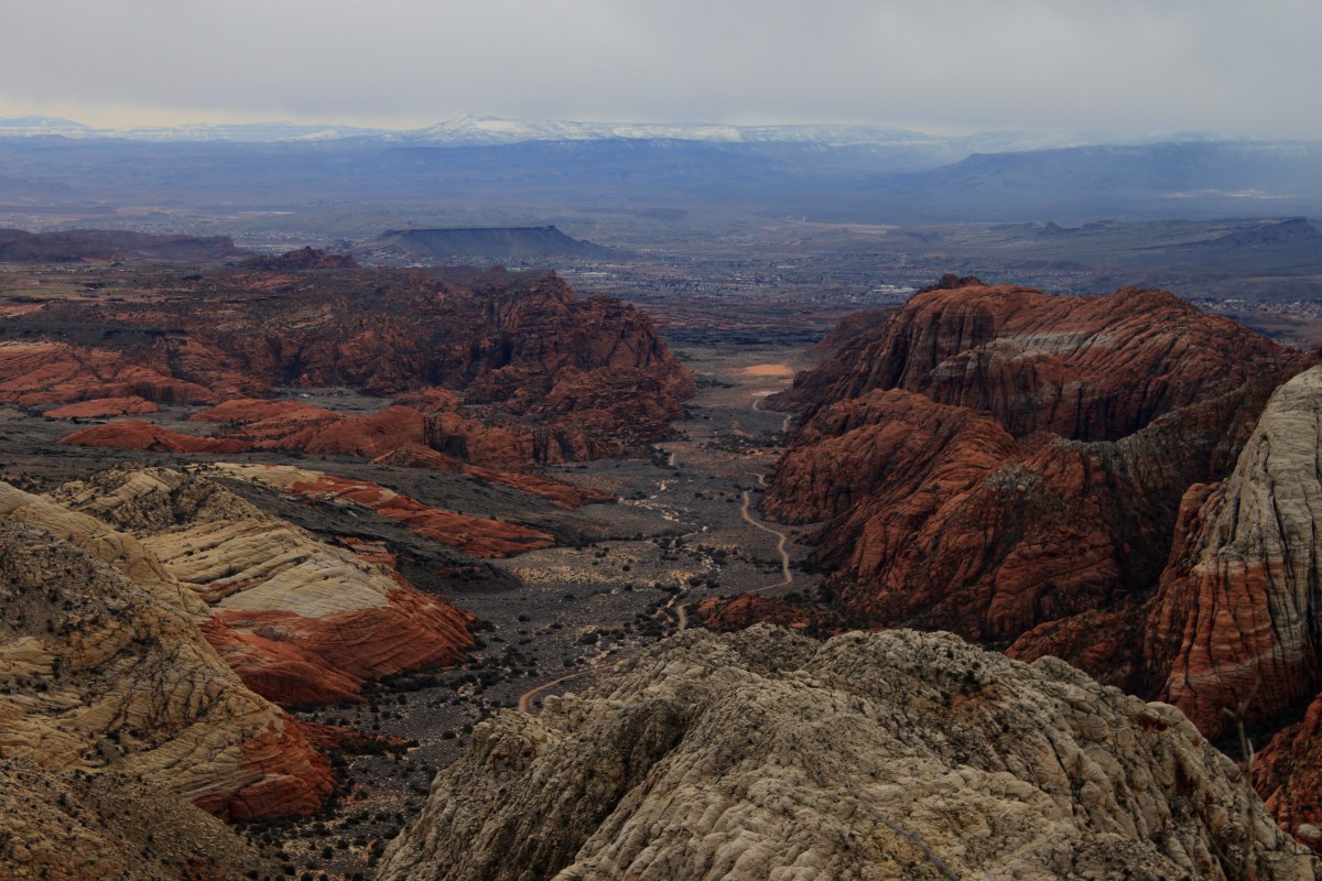 Overlooking Snow CanyonOn Saturday, 27 Feb. 2010, my brother Kendall and I decided to go hiking. It was a beautiful day—overcast with low clouds encroaching and enveloping the surrounding mountains, threatening to rain. When you live in red rock desert county, rainy days bring out the desert colors. Temperatures were in the forties (Fahrenheit), but with no wind, with a light jacket, that's perfect for hiking. Overlooking Snow CanyonOn Saturday, 27 Feb. 2010, my brother Kendall and I decided to go hiking. It was a beautiful day—overcast with low clouds encroaching and enveloping the surrounding mountains, threatening to rain. When you live in red rock desert county, rainy days bring out the desert colors. Temperatures were in the forties (Fahrenheit), but with no wind, with a light jacket, that's perfect for hiking.
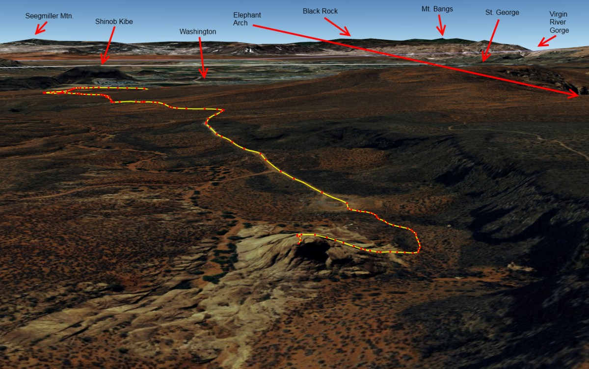
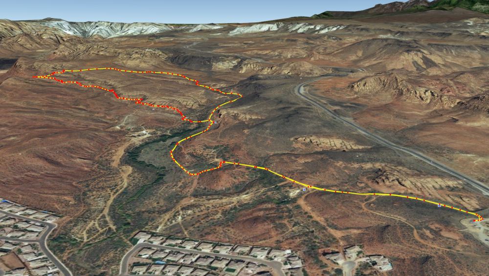
Kendall's Utah State Park pass was about to expire, so we decided to visit nearby Snow Canyon State Park. As we reached the intersection with State Route 18, we decided to turn north on 18 and enter the park at the north entrance just north of Winchester Hills. 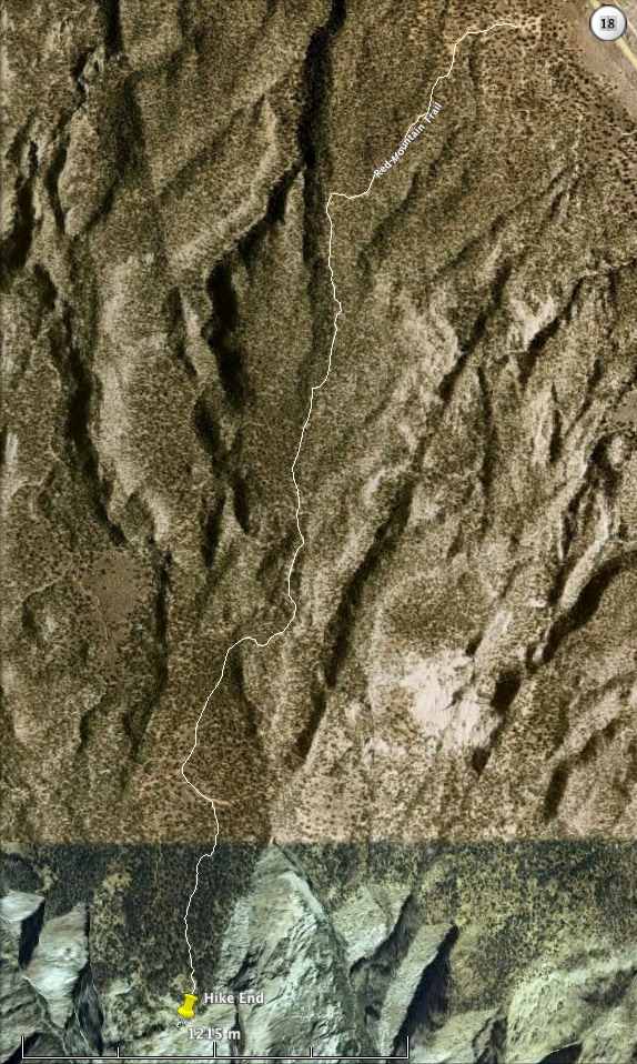 Snow Canyon Hike RouteBefore we reached the entrance, however, we decided to continue past, up through Diamond Valley, and a tad beyond, to the Red Mountain Trail trailhead. I wanted to revisit a hike I'd made years ago to a virtual Geocache at the top of Snow Canyon, a hike Kendall had done many times as a guide working for Red Mountain Spa. Snow Canyon Hike RouteBefore we reached the entrance, however, we decided to continue past, up through Diamond Valley, and a tad beyond, to the Red Mountain Trail trailhead. I wanted to revisit a hike I'd made years ago to a virtual Geocache at the top of Snow Canyon, a hike Kendall had done many times as a guide working for Red Mountain Spa.
Just outside of Diamond Valley, as State Route 18 made a bend towards the north, aiming us almost directly at the cinder cone up ahead that stands above the community of Veyo, between Veyo and the even-closer Dammeron Valley, we stopped, leaving the road, turning left (west) onto a dirt road—well more of a dirt driveway and parking lot among the juniper and piñon pine trees beside State Route 18. There we parked, amidst a herd of trucks attached to horse trailers. Apparently the equestrians were out in force this cloudy, cool day. And indeed they were! We saw riders galore as we embarked on the sand-and-rock Red Mountain Trail, beginning our slow ascent, twisting through the trees up the gentle hillside slope. Having had significant surgery in September of 2009, returning to a semblance of normal life only by December, I certainly could feel my frailty as the trail wound ever higher up the hill, heading first southwestward, then nearer the ridge summit, turning south to follow the summit towards Snow Canyon. I was soon huffing and puffing, but grateful that I could do this hike. Once we reached the top of the ridge, we paused and looked around a bit, sipping our water bottles. Pine Valley Mountain remained enshrouded in clouds, only the lower foothills, sprinkled with a light dusting of new snow, visible. Wisps of clouds trailed gently down the slopes, a warning to us that should the weather change, the sky could quickly lower and envelope us in mist, rain, or even snow. We resumed our hike southward, and remained dry for the time being—well, free of rain, though not completely dry, as hiking even with a light jacket in cool air had me sweating. The recent-rain-moistened red sand of Southwestern Utah beneath our feet really made the brilliantly white, thin patches of melting snow that lurked atop the ridge wherever shade afforded protection from the sun's warmth stand out sharply in contrast. Wow! Beautiful! 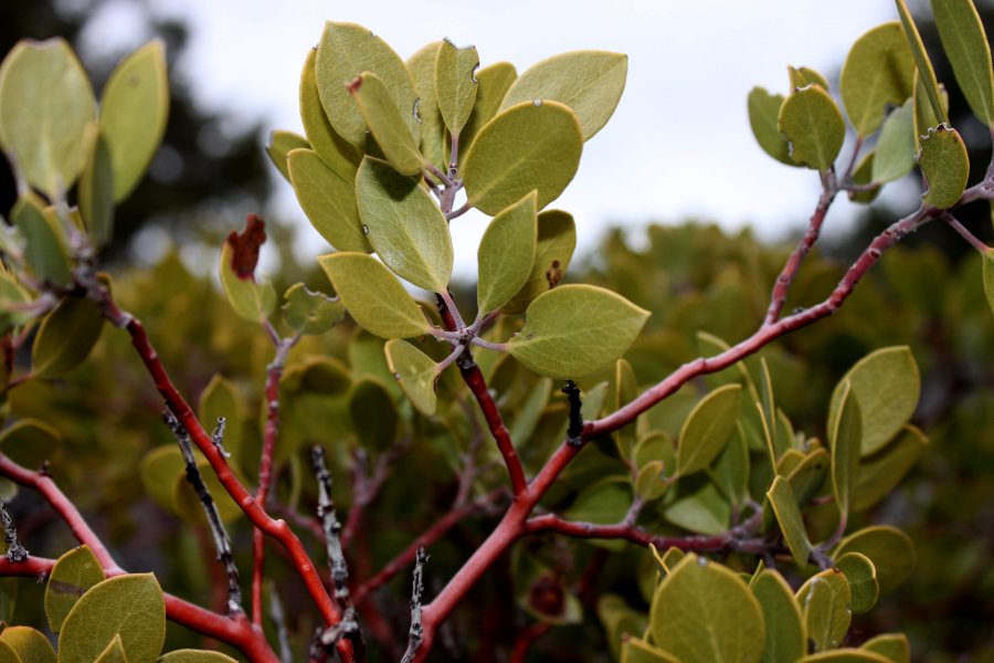 Manzanita above Snow CanyonWe stopped several times the latter part of our hike out to the top of the canyon and snapped photos. It's always beautiful to see open white and red sand and also undisturbed cryptobiotic soil crusts, sandstone rocks, lichen-encrusted rocks, manzanita shrubs, their thick oval green leaves contrasting their smooth reddish bark, yucca, cacti, junipers, and significantly taller piñon pine trees—they seemed to grow better or at least taller at the somewhat higher altitude nearer our destination. Manzanita above Snow CanyonWe stopped several times the latter part of our hike out to the top of the canyon and snapped photos. It's always beautiful to see open white and red sand and also undisturbed cryptobiotic soil crusts, sandstone rocks, lichen-encrusted rocks, manzanita shrubs, their thick oval green leaves contrasting their smooth reddish bark, yucca, cacti, junipers, and significantly taller piñon pine trees—they seemed to grow better or at least taller at the somewhat higher altitude nearer our destination.
The last part of the trail, instead of a rough, broken-sandstone-rock old jeep trail, was a soft, sandy path, the sand growing deeper—making me even more grateful that it was wet which makes it firmer, and walking easier. Kendall, ahead of me, followed the trail around a bend, through a cut about his height in a sand dune. On the other side of that dune, in a few more steps, we caught sight of the sandstone hilltops that surround Snow Canyon. A few more steps, and suddenly, a giant gaping chasm opened beneath our feet, and sheer sandstone cliffs halted our forward progress. We had arrived! Wow! What a view! Stretching before us, beneath us, were the several merging canyons in Snow Canyon State Park. White sandstone dominated to the left (east), red to the right (west), and in the misty distance, we could see parts of Santa Clara and parts of the Dixie Downs and Green Valley area of St. George. On the black lava basalt-edged bench to the right, perched Winchester Hills and The Ledges golf course. (Those who own homes there have a stunning view looking down into Snow Canyon from the western side.) In the far, far distance, a thin horizontal line was visible, the Hurricane Cliffs, and perched atop, a flat, familiar pyrmidal shape was visible, Mount Trumbull in Arizona, close to the edge of the Grand Canyon. I could also make out the closer Seegmiller Mountain south of St. George. Mount Bangs and Black Rock (south and southwest of St. George) were too cloud-enshrouded, as were West Mountain, Scrub Peak and the rest of the hills and mountains I grew up calling Utah Hill (part of the Beaver Dam Mountains west of St. George). Hike Destination at maps.google.com We spent quite some time there at the rim of the canyon. When we finally gathered our things for the return journey, weather looking even more ominous, a few droplets of water warning us of what could be coming our way, it was hard to depart that stunning locale. Wow, wow, wow, wow, WOW! I was in natural beauty overload. Despite the low clouds and what looked like fresh snow on the foothills of Pine Valley, it didn't actually rain on us until we were nearly back to our vehicle, and then it only sprinkled tiny droplets, almost a mist, so that we were barely wet when we did arrive. Once back in my RAV4 (the RAV4's steering fixed under warranty the day before the warranty expired, thank goodness!), the rain picked up just a bit, though it never really rained hard at all. It was beautiful. On our way back home, we did enter Snow Canyon State Park at the north entrance, and idled leisurely down the road, pausing so I could take a few more photos. What a beautiful place! I love it! 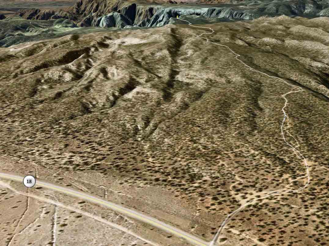 Snow Canyon Hike Route in 3-DThanks for the hike, Kendall! It was great to finally get back there. Snow Canyon Hike Route in 3-DThanks for the hike, Kendall! It was great to finally get back there.
All in all, having measured our route in Google Earth—check out the Google Earth screenshots of the route I've included with this post—we hiked only 4-and-a-half miles, two-and-a-quarter out, two-and-a-quarter back. For me, post surgery, that's doing well. I hope to be able to do longer hikes this spring and summer. In case you wonder where exactly our hike terminated, check out the embedded Google Map with the green arrow (at least it SHOULD be green—it was in my web browser) right at the top of the canyons where we stopped. What a blast! Just a Cache at Twilight
Friday, 10 February 2006 6:45 PM MST
Astounding Adventures
 Approximage Trail RouteCache Found: Cinder Cone Jar by Madness and Mayhem Approximage Trail RouteCache Found: Cinder Cone Jar by Madness and Mayhem
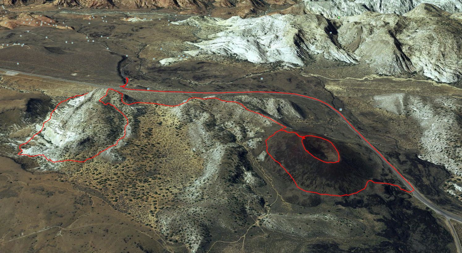
Trave Bug Found: Hotspur the Dragon found by Percible (my brother) Friday, 10 February 2006 - 6:45 PM MST (-0700) It was late in the afternoon, and brother, whose geocaching.com handle is Percible, and I were both going a little crazy from being inside all day, staring a computer screens. He called me up and we made an agreement: He would grab his G.P.S. receiver then drive over from Hurricane to my house in St. George to pick me up. It was my job (And a tough one, I'm tellin' ya!) to pick a cache to go visit. We didn't have much light left, as the winter sun was nearing the horizon already. By the time he arrived at my house and I was ready to go, it was well past 5:00 PM MST (-0700 GMT). Anxious to go, I grabbed my stuff and was about to hurry out the door when I realized I'd not yet picked a cache and print out the description and coordinates. It was another 15 minutes, due both to the difficulty deciding which cache to visit and owing to some minor computer glitches that froze my web browser several times, before we had the coordinates to a cache atop a cinder cone near Diamond Valley and were away. We drove northward out of... Read the rest of this article... Double Caches and a Sky Ablaze in Color
Saturday, 28 January 2006 5:00 PM MST
Yakkity Yak, Astounding Adventures
 Fascinating Sky Over the Rio VirginCache Found: A Bridge Over Troubled Water by call2teachfamily Fascinating Sky Over the Rio VirginCache Found: A Bridge Over Troubled Water by call2teachfamily
Saturday, 28 January 2006 - 5:00 PM MST (-0700) Found at last! 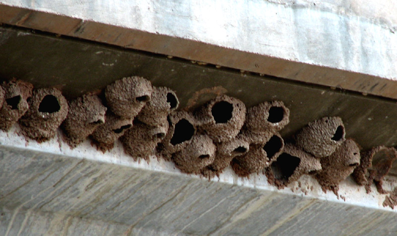 Nests on the BridgeYou might not know it, but there's been an unregistered cache hidden only 50 feet away in the rocks by the trail since March of 2003 (Wednesday, 19 March 2003 at 3:45 PM MST (-0700) to be precise). I hid it when my sister from Colorado was visiting, then promptly forgot to register it with Geocaching.com. I even visited it again in the summer of 2003 (Saturday, 20 Sept. 2003 at 7:00 PM MDT (-0600), with a friend) with the intent to register it. Nests on the BridgeYou might not know it, but there's been an unregistered cache hidden only 50 feet away in the rocks by the trail since March of 2003 (Wednesday, 19 March 2003 at 3:45 PM MST (-0700) to be precise). I hid it when my sister from Colorado was visiting, then promptly forgot to register it with Geocaching.com. I even visited it again in the summer of 2003 (Saturday, 20 Sept. 2003 at 7:00 PM MDT (-0600), with a friend) with the intent to register it.
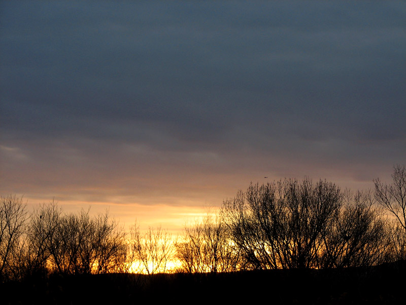 The Setting SunThat's what I get for not being diligent in registering it with www.geocaching.com. Besides, I love the name you picked for this cache, and I love the little bit of history of the Quail Creek Reservoir dike-break flood of 01 January 1989 washing out the bridge that you included in the cache, call2teachfamily! The Setting SunThat's what I get for not being diligent in registering it with www.geocaching.com. Besides, I love the name you picked for this cache, and I love the little bit of history of the Quail Creek Reservoir dike-break flood of 01 January 1989 washing out the bridge that you included in the cache, call2teachfamily!
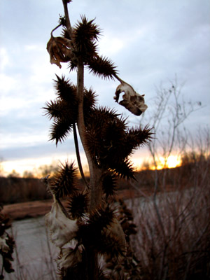 Spiky SilhouetteI took a Dory toy (You know, Dory from "Finding Nemo") and left a "Polar Express" DVD in exchange. Spiky SilhouetteI took a Dory toy (You know, Dory from "Finding Nemo") and left a "Polar Express" DVD in exchange.
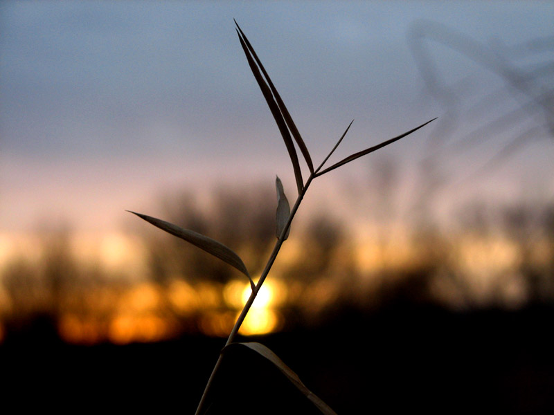 Riverside Grass Silhouette Riverside Grass Silhouette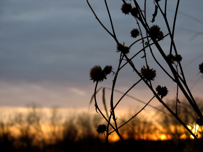 Another SilhouetteAfter writing in the log book, I extracted the old 2003 cache from the nook in the rocks by the bike/walking trail. Apparently it didn't survive the January floods of 2005 unscathed. It was completely submerged by the flood. In spite of an otherwise weather-proof plastic jar container, the contents inside were still soaked, though the log book was only damp, having had an additional layer of protection in the form of a ziploc plastic bag. Another SilhouetteAfter writing in the log book, I extracted the old 2003 cache from the nook in the rocks by the bike/walking trail. Apparently it didn't survive the January floods of 2005 unscathed. It was completely submerged by the flood. In spite of an otherwise weather-proof plastic jar container, the contents inside were still soaked, though the log book was only damp, having had an additional layer of protection in the form of a ziploc plastic bag.
It was surprising to see that lewmil, who registered a find of this cache on the 13th of December 2005, apparently stumbled across my old unregistered cache a day earlier on the 12th, and made a note entry in the log book. Wow! That's funny. 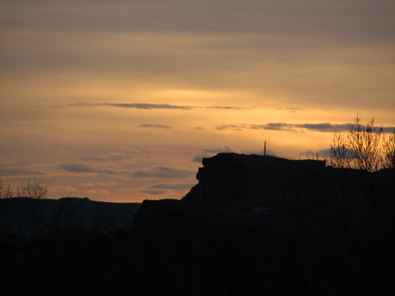 Sky Over Bloomington Hill Sky Over Bloomington Hill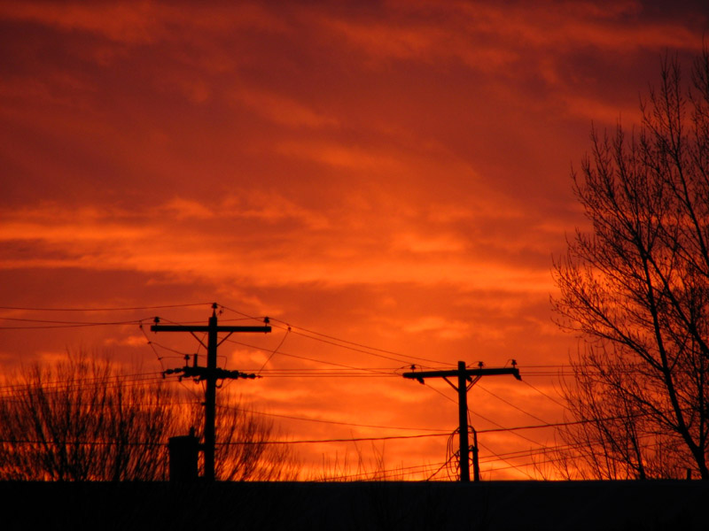 Power Pole SilhouetteI've removed the unregistered cache so no one else will accidentally find it and think that it it this cache. I'll go hid it somewhere else once I clean it up and dry it out. Power Pole SilhouetteI've removed the unregistered cache so no one else will accidentally find it and think that it it this cache. I'll go hid it somewhere else once I clean it up and dry it out.
Thanks, call2teachfamily, for a fun evening find! Oh, and the sunset was absolutely stunning. I stuck around for over an hour just to watch the colors change in the sky. Then I grew impatient and left shortly before the sun broke through the clouds on the horizon and lit up the whole sky in a blaze of glorious color, illuminating the clouds from beneath. When I did notice, looking up out my car window, I immediately pulled over and snapped a few more pictures of the sky. -Astounding St. George, Utah
Page 1 of 4
| |